14 TUMBLEWEED RD
Owner Information
WHITE GEORGE L
14 TUMBLEWEED ROAD
SPRINGFIELD, MA 01109


Property Details
14 TUMBLEWEED RD is classified as a Single Family Residential (Ranch).
The primary structure on this property was built in 1956. There is 1,086ft2 of residential/living space within this property. This property is listed as having 6 rooms.
14 TUMBLEWEED RD is valued at $185,200. The land is valued at $49,700 and the structures are valued at $135,500.
This property is in Zone R1. Confirm with local Zoning Board authorities to ensure there are no overlays or other easements on this property.
The most recent deed for 14 TUMBLEWEED RD is recorded at the local registrar in Book 52, Page 127. 14 TUMBLEWEED RD was last sold on Monday, January 1, 1900 for $0.
Assessment data from fiscal year 2022.
Flood Data
According to the FEMA National Flood Hazard Layer, this property does not appear to be in a flood zone. It may also be in an area not yet reviewed. Nonetheless, confirm this information prior to taking any action.
To view the flood hazards around this property, create a FEMA "Firmette" Map of the area around 14 TUMBLEWEED RD.
Broadband Internet Providers
| Provider | Type | Bandwidth (mbps) | |
|---|---|---|---|
| Verizon New England Inc. | DSL | 15 | 1 |
| GCI Communication Corp. | Satellite | 0 | 0 |
| HughesNet | Satellite | 25 | 3 |
| Viasat Inc | Satellite | 100 | 3 |
| VSAT Systems, LLC. | Satellite | 2 | 1 |
| Comcast | Cable | 1000 | 35 |
Broadband service provider data from December 2020.
Adjacent Properties
- 218 CHEROKEE DR
Single Family Residential owned by BABCOCK SHIRLEY A & WILLIAM W JR - 4 TUMBLEWEED RD
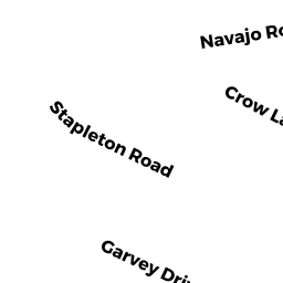
Single Family Residential owned by ROGERS QUINTON - 245 STAPLETON RD
Single Family Residential owned by PANNELL MENTORIA S - 24 TUMBLEWEED RD
Single Family Residential owned by MARQUEZ ILIANA TORRES - 253 STAPLETON RD
Single Family Residential owned by WHITNEY JAMES JR & DWAYNE L